|
Where is Eivissa? |
. . . . . . . . . . . . . . . . . . . . . . . . . . . . . . . . . . . . . . . . . . . |
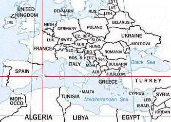
 Eivissa, known as Ibiza during the rein of Generalissimo Francisco Franco, is one of the Balearic islands. It's located off the Spanish peninsula in the western Mediterranean basin.
It's called "Eivissa" from the Catalan language has been adopted after the Franco regime. The local dialect is "Ibizenc" which is, for foreigners, as hard to understand or to speak as is Catalan. Hereafter we will use Catalan or Ibizenc for all geographic names, their Spanish name in brackets.
GeographyEivissa and it's neighbor island Formentera are the most southern islands of the Baleares. They're also called Pitiusas (from petit = small) because they are smaller in size than Mallorca and Menorca, the other Balearic islands. Eivissa's is about 550 square kilometers. The island is roughly round with a diameter of about 45 kilometers. The capital city has the same name as the island; it's a charming harbor town of 60,000 people located in the south. Other cities of note are Santa Eularia (Santa Eulalia) and Sant Antoni de Portmany (San Antonio). The main villages are Sant Rafel (San Rafael), Santa Gertrudis, Sant Josep (San Jose), Santa Agnes, San Mateo, Sant Miquel de Balanzat, Sant Joan de Labritja (San Joan), Sant Vicent (San Vicente), and Sant Carles (San Carlos). Some smaller villages around the capital like Jesus, Sant Franisco, and Sant Agusti. There are several notable ports, each about five kilometers from their namesakes: Sant Miquel and the Port de Sant Miquel, Sant Vicent and Cala Sant Vicent. In the north is the town of Sant Joan de Labritja with the port of Portinatx. About 10,000 people live outside the capital.
TerrainThere are two mountain ranges on the island, one in the south-west and one in the north-east. The highest peak is the Atalaya mountain near Sant Josep with an altitude of 476 meters. The lowest stretch of land is in the south where the salt fields are still productive. The total coastline is about 500 km long and is of variable terrain, from rocks to pebbles to sand. The closeness to Africa is responsible for the relatively hot summers and mild winters. The rainfall has changed somehow with the global climate change, but usually there is only rainfall between October and May which adds up to about 350 mm/cm2.
HistoryEivissa's history dates back to the 17th century BC as a landmark. Its first colonization started by the Phoenicians in the 8th century BC followed by the Carthaginians, which founded Ebesus (named after their goddess Bes) in 654 BC. After this many rulers set foot on the island: the Romans (2nd century BC), Vandals (455 AD), Byzantines (534 AD), the Moors (8th and 9th century), and the Normans until it was incorporated into Christianity in 1235 by the Catalans who brought an end to the changing rulers. For about 750 years life on Eivissa has been very simple. Salt was exported, fish were caught, farms grew everything people needed, industry was absent. The first tourists were British and sailed to the island in the 30s. In the late 50s the first artists arrived with the weekly ferry from Barcelona, followed by the so called Hippies in the 60s. After the airport was built in the late 60s and the harbor was dug-out for bigger ferry boats, mass tourism started, leaving only the parts of the island without direct access to the sea close to their original ways of life.
|